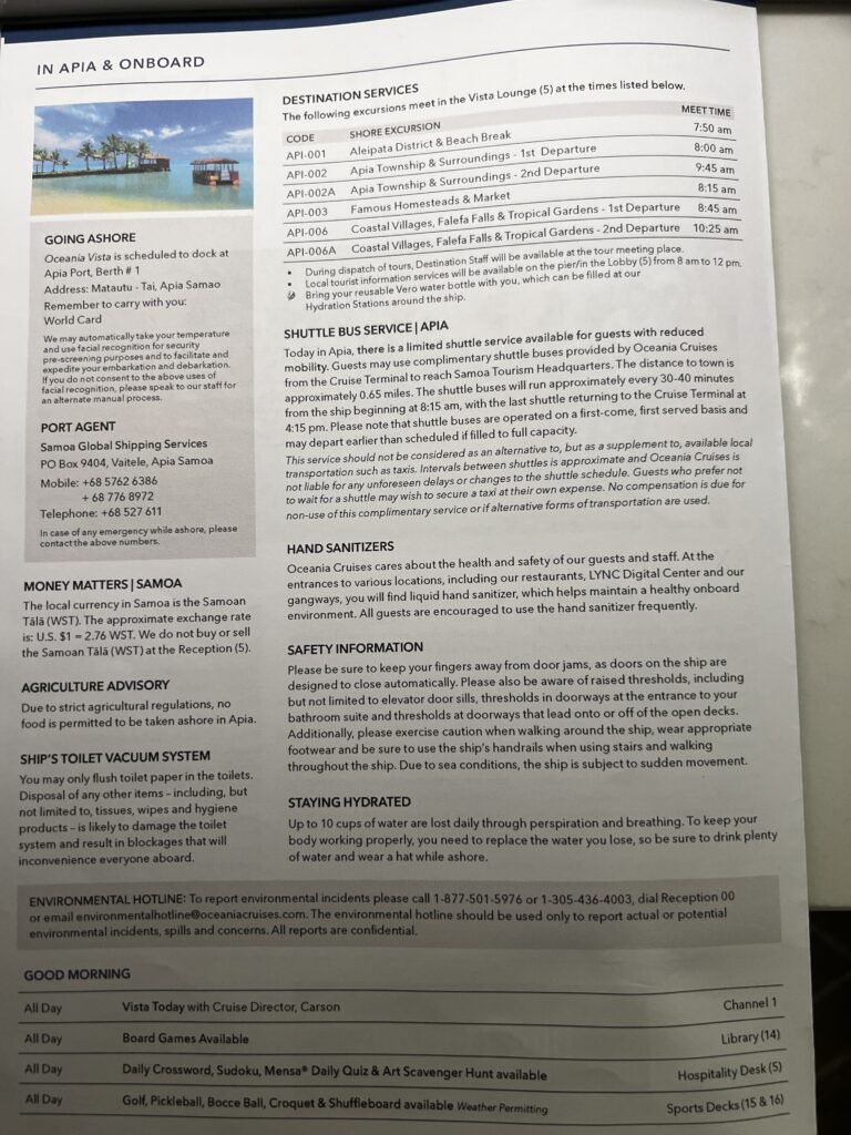
Day 24 Monday March 30th (96 days to go) — We arrived in Apia, Samoa today which is a new location for us. We had a small groups full day tour booked with Summer Wind Samoa. The tour was a good one as we went from end of the island to the other. Our guide for the day was Sasa, a young Samoan man who also plays rugby and had the body of a rugby player. He was fantastic and possibly the politest guide we have ever had on a tour. There were three other passengers with us on the tour which would bring us to these locations:
Piula Cave Pool – A cool freshwater pool inside a cave, great for swimming and relaxing
Sopoaga Falls – A tall, beautiful waterfall surrounded by gardens and greenery
Lalomanu Beach – White sandy beach with clear blue water, perfect for swimming and enjoying the view
To Sua Ocean Trench – A deep natural swimming hole connected to the sea, famous for its amazing scenery
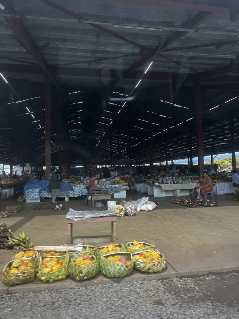
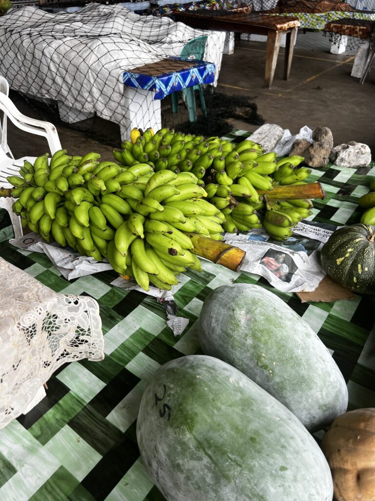
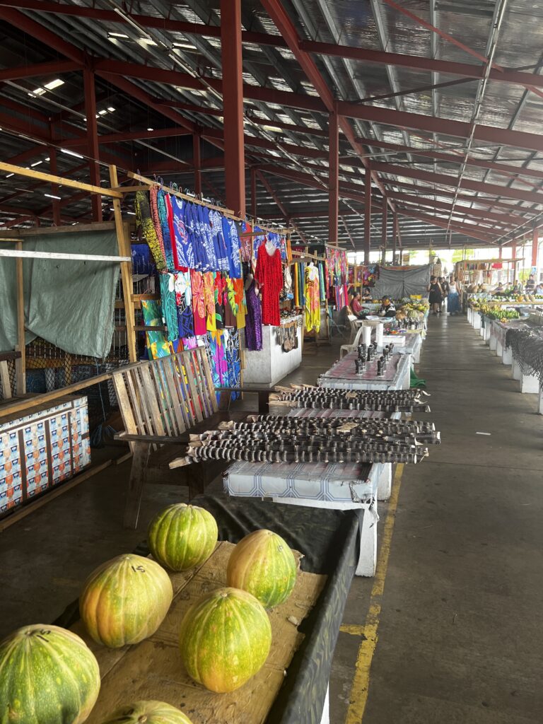
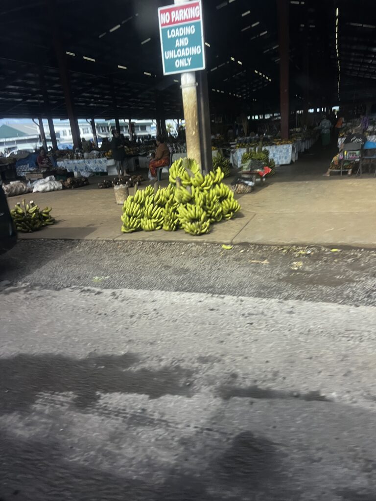
Apia Market – A lively market where locals sell fresh fruit, food, handmade crafts and handsewn clothing
Immaculate Conception Cathedral
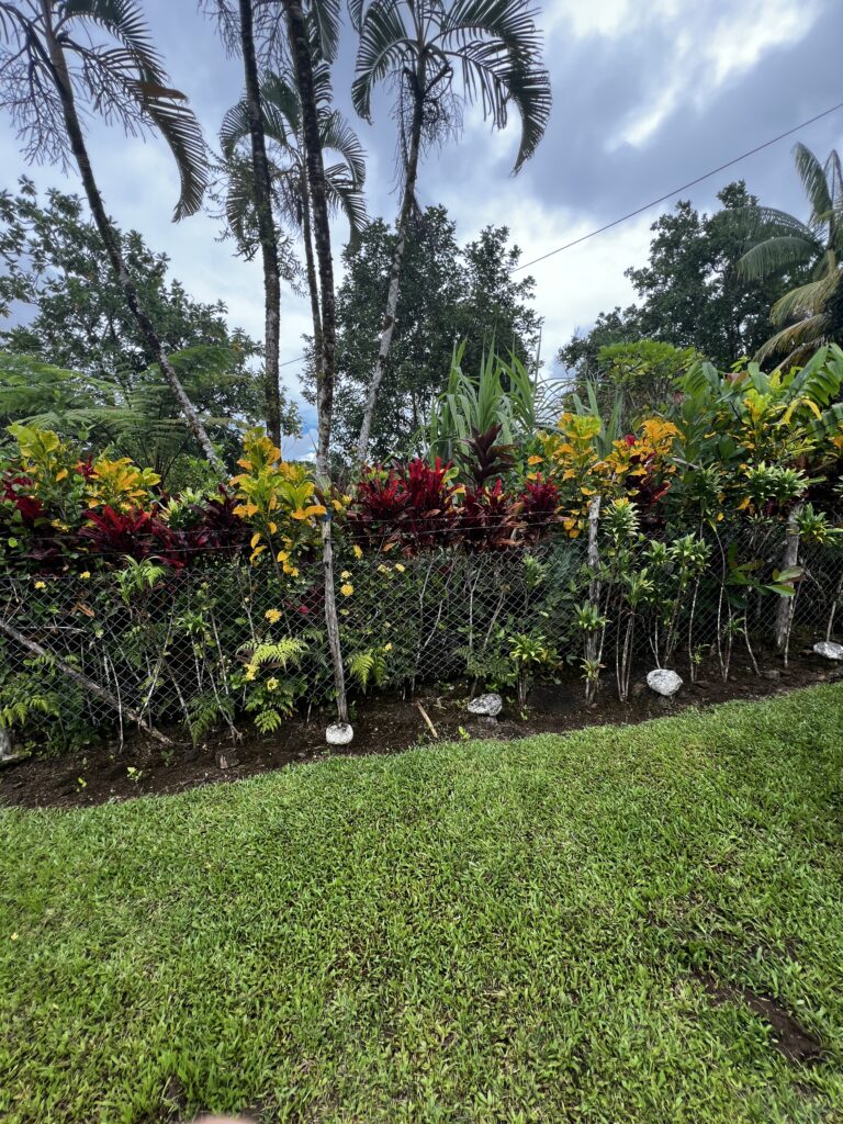
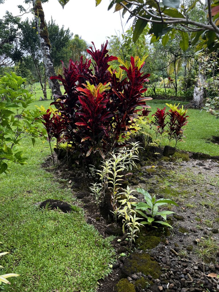
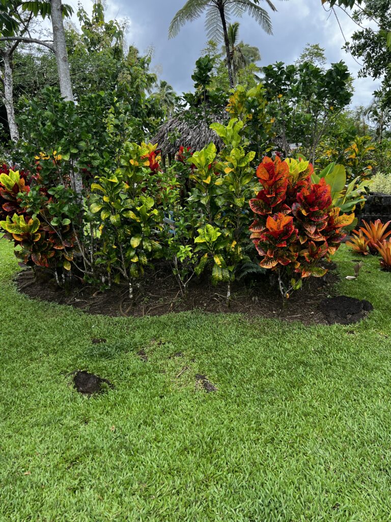
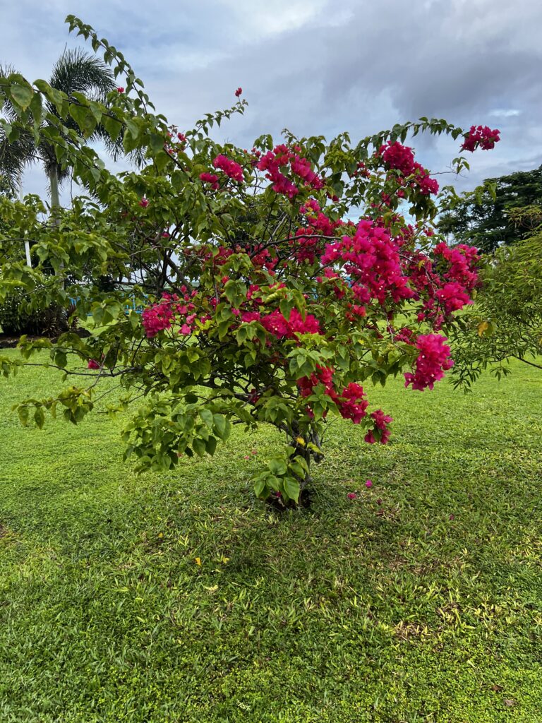
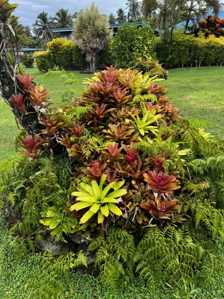
The only negative for our day was the amount of rain that fell throughout the day. This island is simply beautiful and the pride the residents take in their country and island stands out at every turn. There are a number of small towns on the island and each town’s residents plant beautiful plants in the front of their properties along the roadside. So, as you drive it is just a constant show of colors. It was truly amazing.
I will work on our American Samoa visit. When I post it, you will notice the date was March 28th and the next day in Samoa is March 30th. We crossed the International Date Line so now we are a day ahead of the United States.
After four hours of trying to upload photos, I decided to call it quits on this day. The next morning, I was able to complete the blog for Samoa which was important for me as it included some poignant photos of a Tsunami that hit Samoa in 2009. I also was able to add a couple of small videos of a waterfall we visited. Be sure to check out the section on Faces Around the World for the residents that we captured today on our photos.


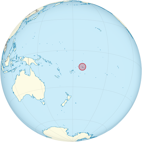
Samoa is a small island country in the central South Pacific Ocean. It is made up of an archipelago of nine islands, four of which are inhabited. The two largest islands are Savai’i and Upolu. Samoa sits about halfway between New Zealand and Hawaii. The country originated from volcanic activity. It is mountainous, with many lakes and rivers. The map below shows we are a long way from home and the Pacific Ocean is just massive in size.
The Lapita people discovered and settled the Samoan Islands around 3,500 years ago. They developed a Samoan language and Samoan cultural identity. Because of the Samoans’ seafaring skills, pre-20th-century European explorers referred to the entire island group, including American Samoa, as the “Navigator Islands”
Apia (Samoan: [a.pi.a]) is the capital and largest city of Samoa. It is located on the central north coast of Upolu, Samoa’s second-largest island. Apia falls within the political district (itūmālō) of Tuamasaga.
The Apia Urban Area (generally known as the City of Apia) has a population of 35,974 (2021 census). Its geographic boundaries extend from the east approximately from Letogo village in Vaimauga to the west in the newer, industrialized region of Apia which extends to Vaitele village in Faleata. Photos of the three stops we made in Apia are:
Apia Market: It was a huge lively market where locals sell fresh fruit, food, handmade crafts and clothing
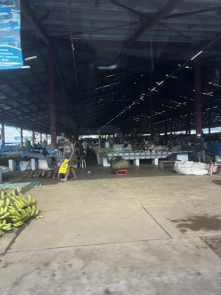
We visited the market at the end of the day. It would have been nice to have more time but the rain during the day put us behind on the schedule. We thought about grabbing a ride back to the market from the ship but with only 90 minutes until departure, it would have been difficult to pull off.
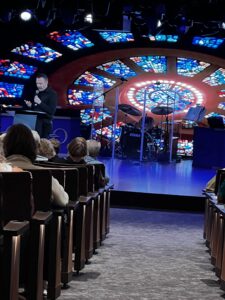
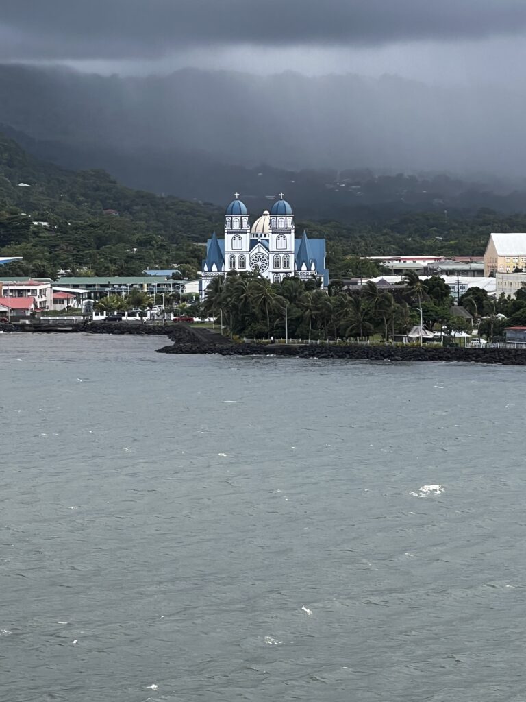
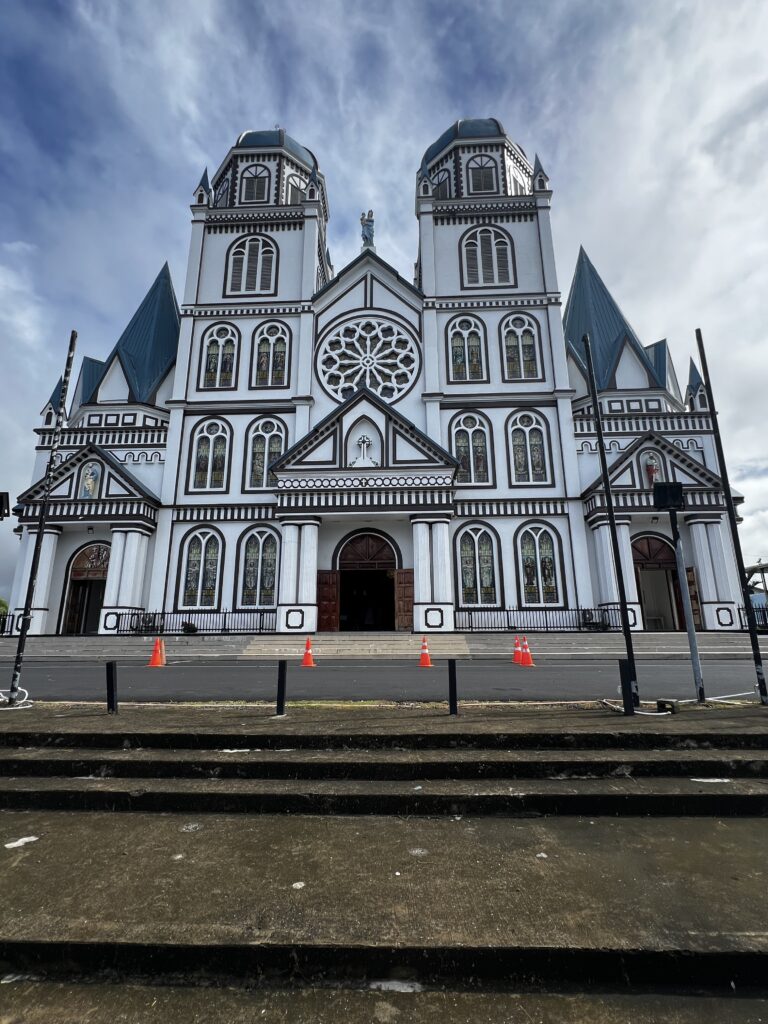
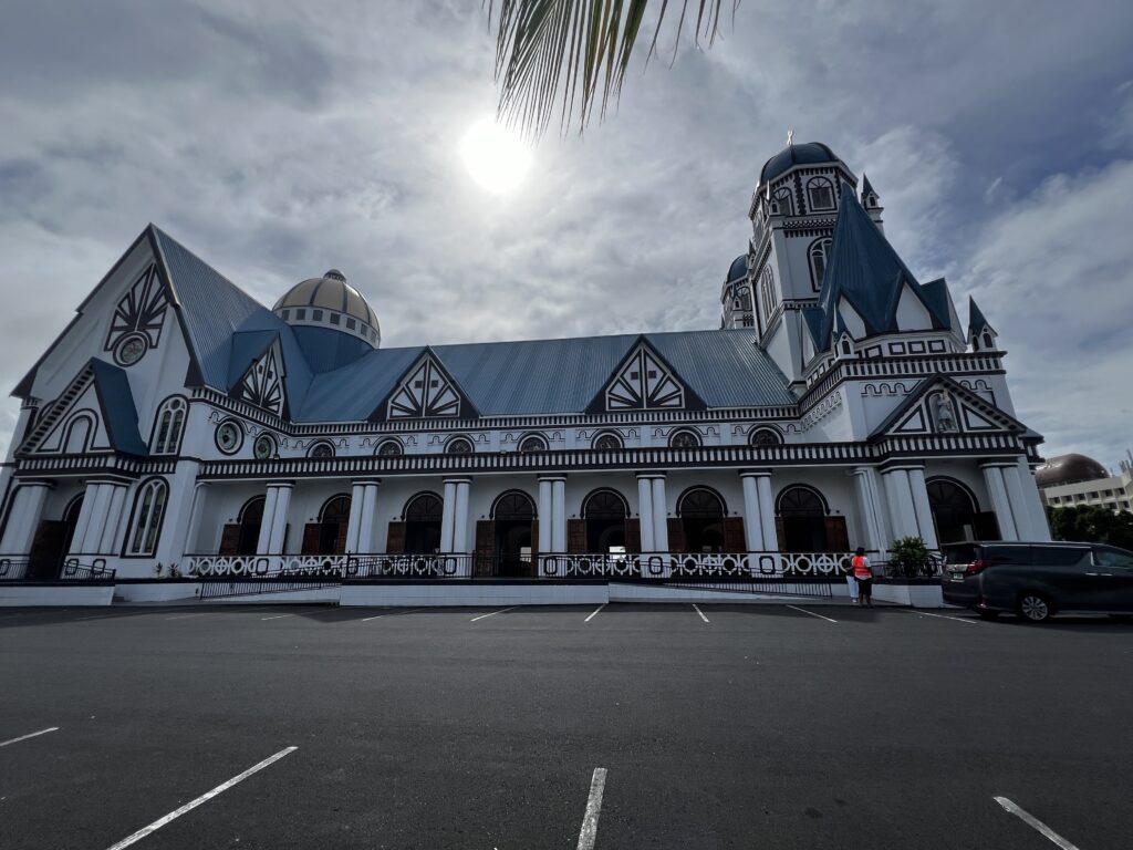
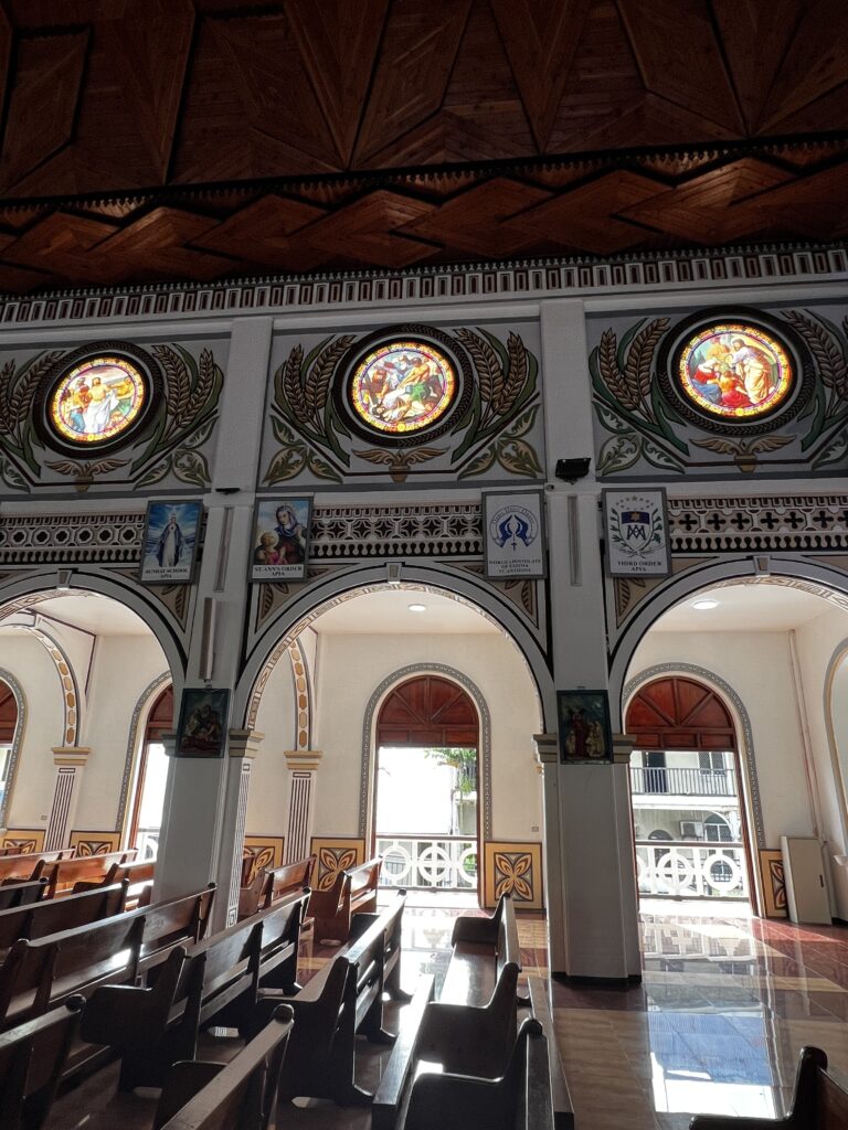
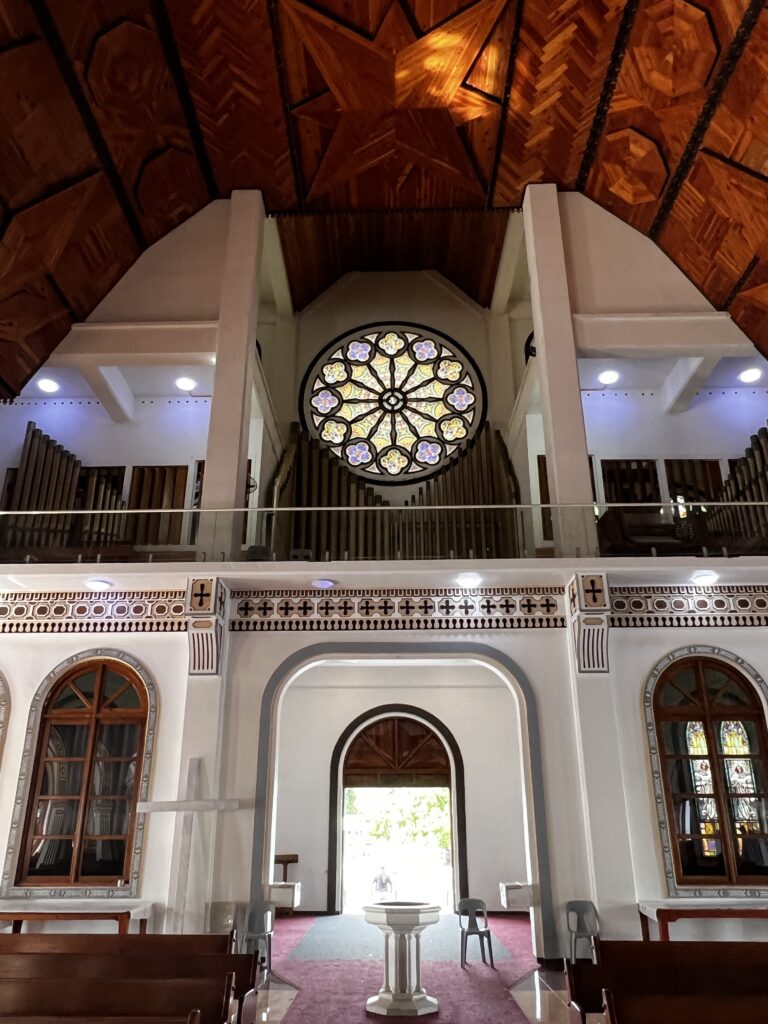
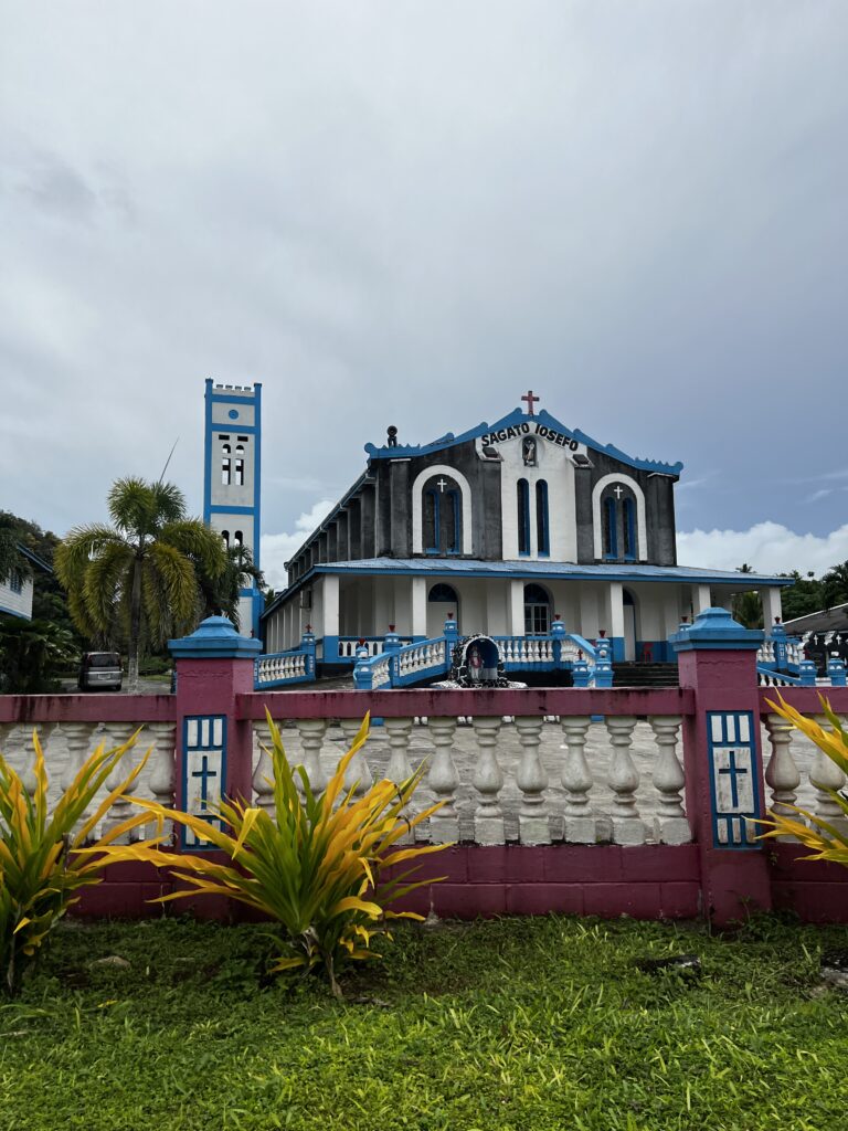
Another stop in Apia was the Immaculate Conception Cathedral. This church was unbelievable with a ceiling we have not seen in any other church that we have visited. It was an open-air church and there was a nice breeze passing through the church. Below is a view of the cathedral from our cabin balcony.
The Immaculate Conception Cathedral (also called Cathedral of Apia or Mulivai Cathedral) is the Catholic cathedral in Apia, the capital of Samoa, an insular country in Oceania. It suffered damage in the earthquake of 2009, and has undergone restoration and extension.
The congregation follows the Roman or Latin rite and is the mother church of the Archdiocese of Samoa–Apia (Latin: Archidioecesis Samoa–Apiana; Samoan: Fa’aAkiepikopo Samoa–Apia), which was created in 1966 by Pope Paul VI through the bull “Prophetarum voes”.
After three years of repairs, the new cathedral of Apia was opened to the public on 2 June 2014 in the presence of Archbishop Martin Krebs, the apostolic nuncio in New Zealand. The church was rebuilt on the site of the original cathedral, which dated from 1857.
In 1852, William Pritchard sold a plot of land in Mulivai, about three-quarters of an acre (or 3000 m²), to Bishop Bataillon, onto which Bataillon’s brother, Jacques, began building a church and a parish house. The first stone was blessed by the bishop on 8 December 1852, but work was interrupted by epidemics and a tropical cyclone in 1854, which destroyed eight ships and caused great damage to the plantations, resulting in problems with the food supply. As a result, the church was completed in 1857.
The church stood in the same place as the current one, while the residence was near Mulivai.
View of the front entrance to the Cathedral
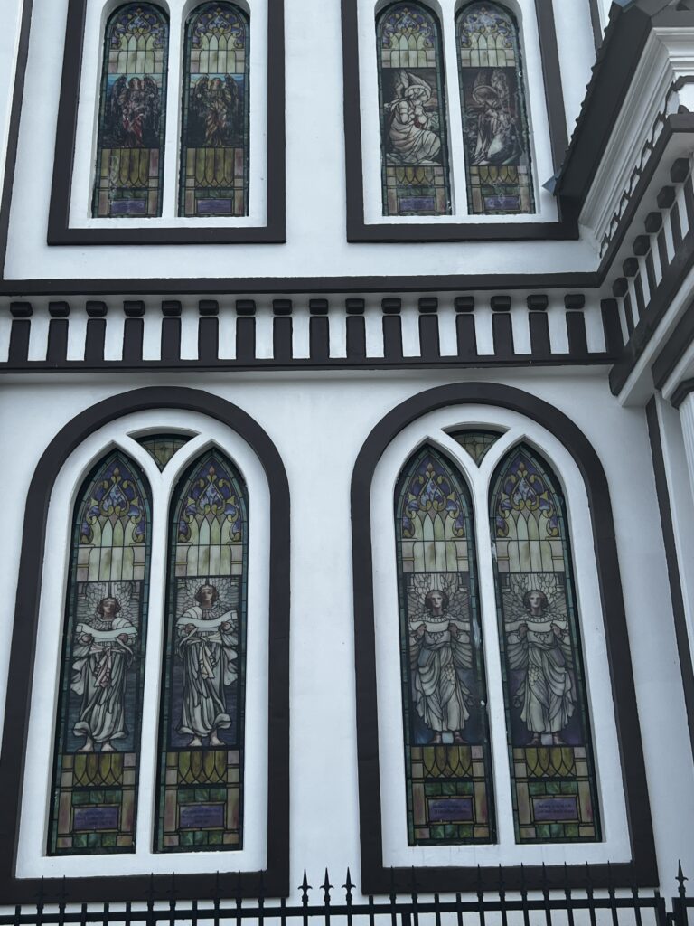
Closeup of the stained glass in the front entrance
Side view of the Cathedral. Notice how you can see through the cathedral as the open doors allow for a free flow of air
View of the cathedral from the front entrance
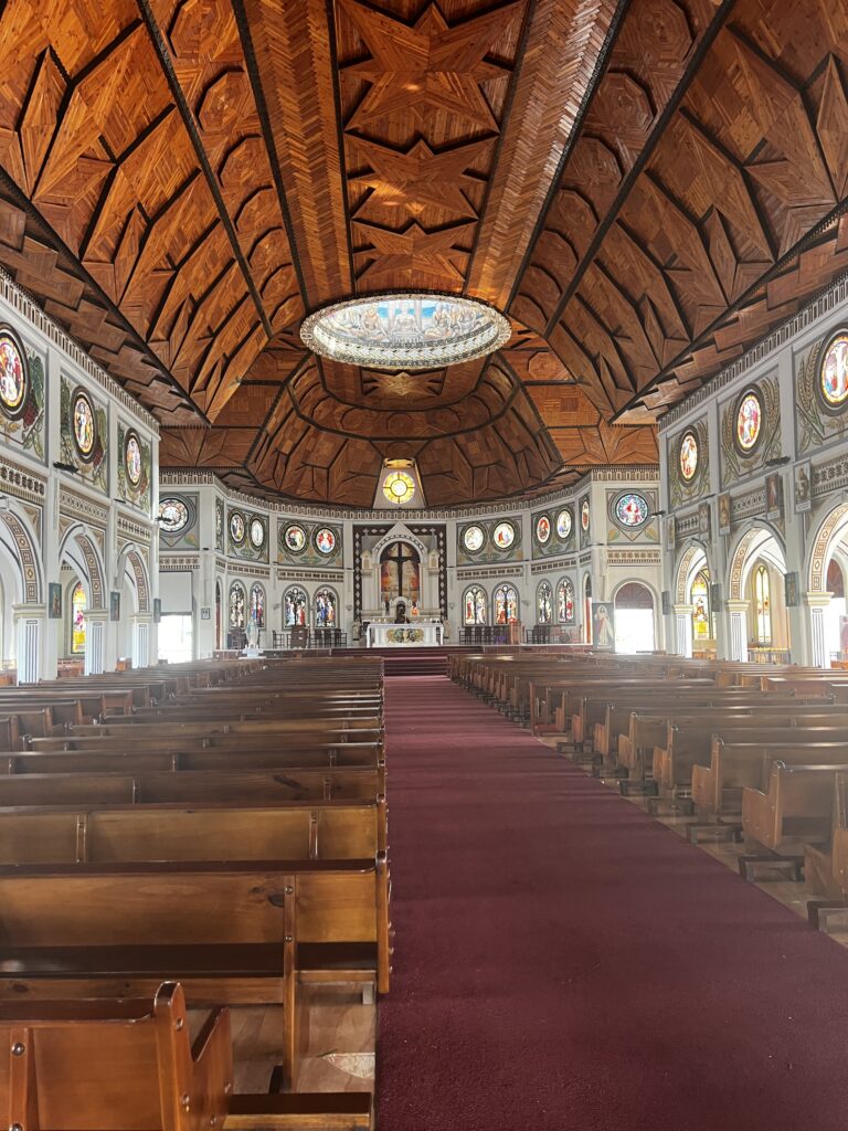
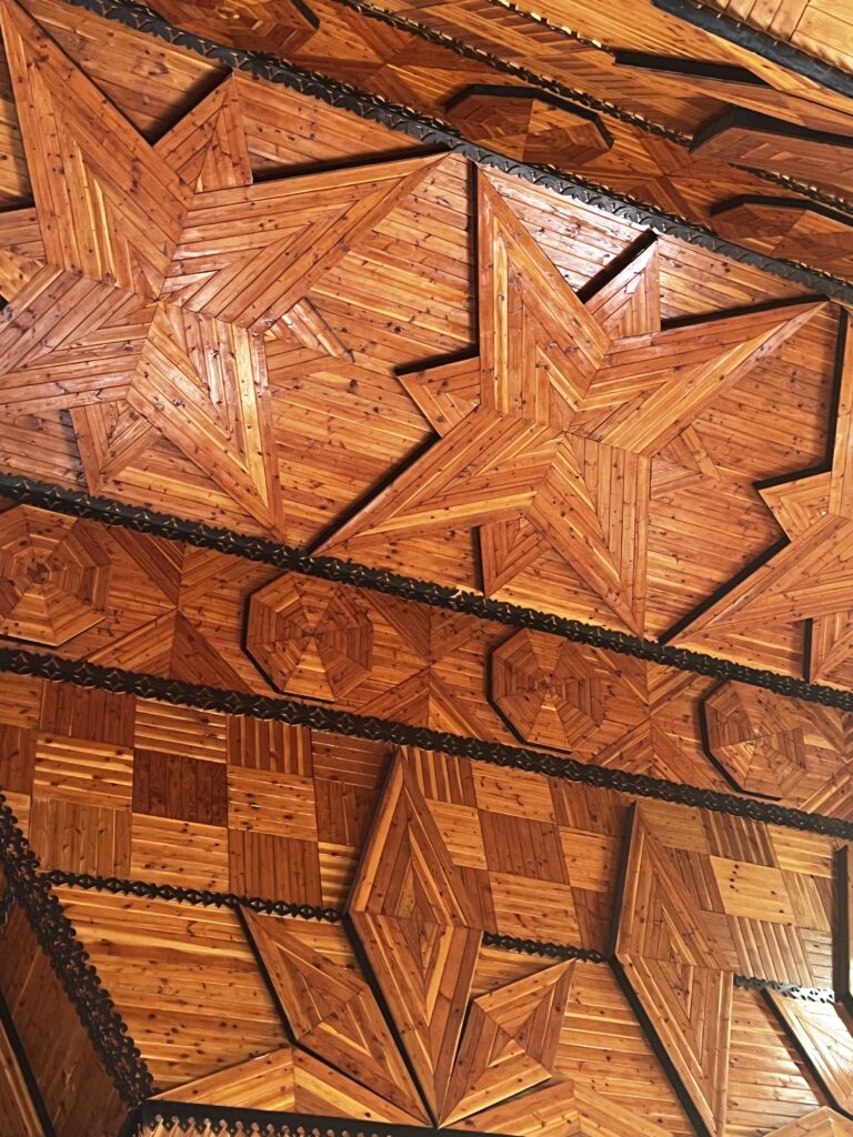
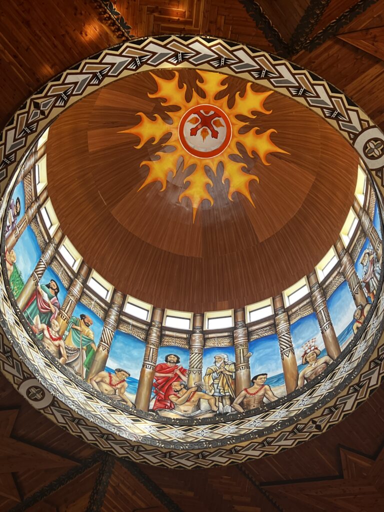
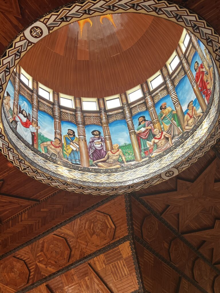
The ceiling of the cathedral was breathtaking.
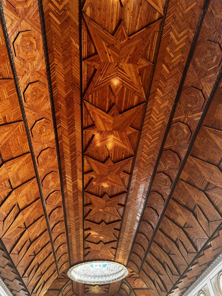
Closeup view of the cathedral ceiling
The Cathedral’s altar
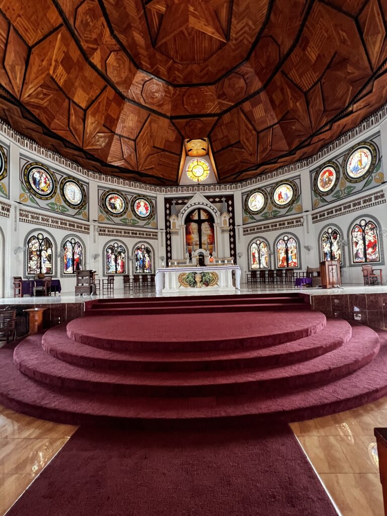
Two photos of the large rotunda near the altar
Doors opened on either side of the cathedral allows for a nice breeze through the cathedral
Large pipe organ at the front entrance of the cathedral
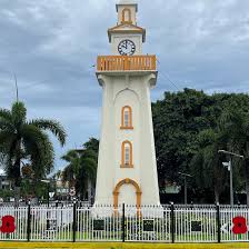
The Apia Town Clock Tower is a substantial and visible monument on a roundabout on Main Beach Road, which commemorates Sãmoan soldiers who died in World War I. Most of them were Sãmoans, already living in New Zealand and fighting for the British with ANZAC troops. It dates from the days of the Western Sãmoa Trust Territory, which was administered by the New Zealand Government from 1920. This is a stock photo as mine did not come out like I wanted.
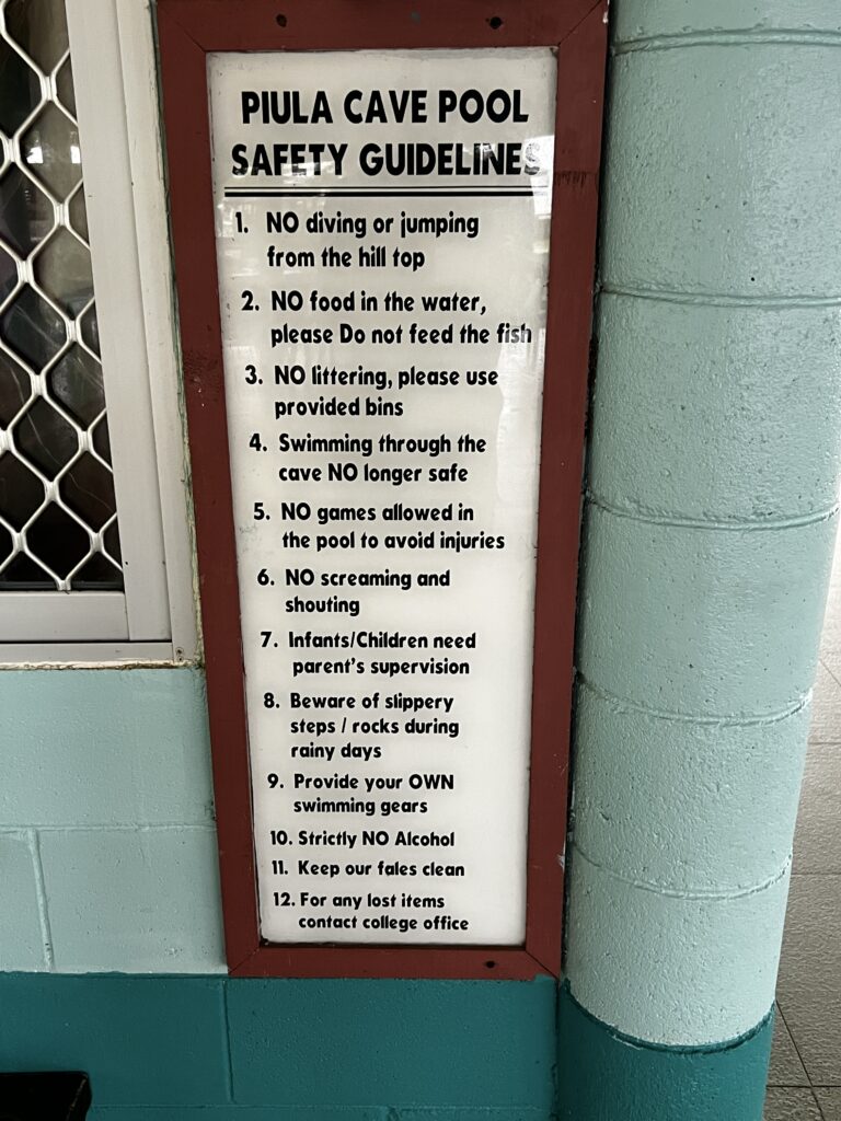
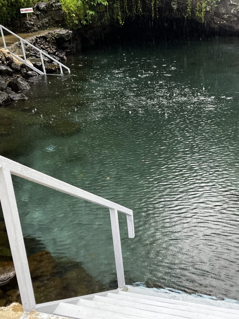
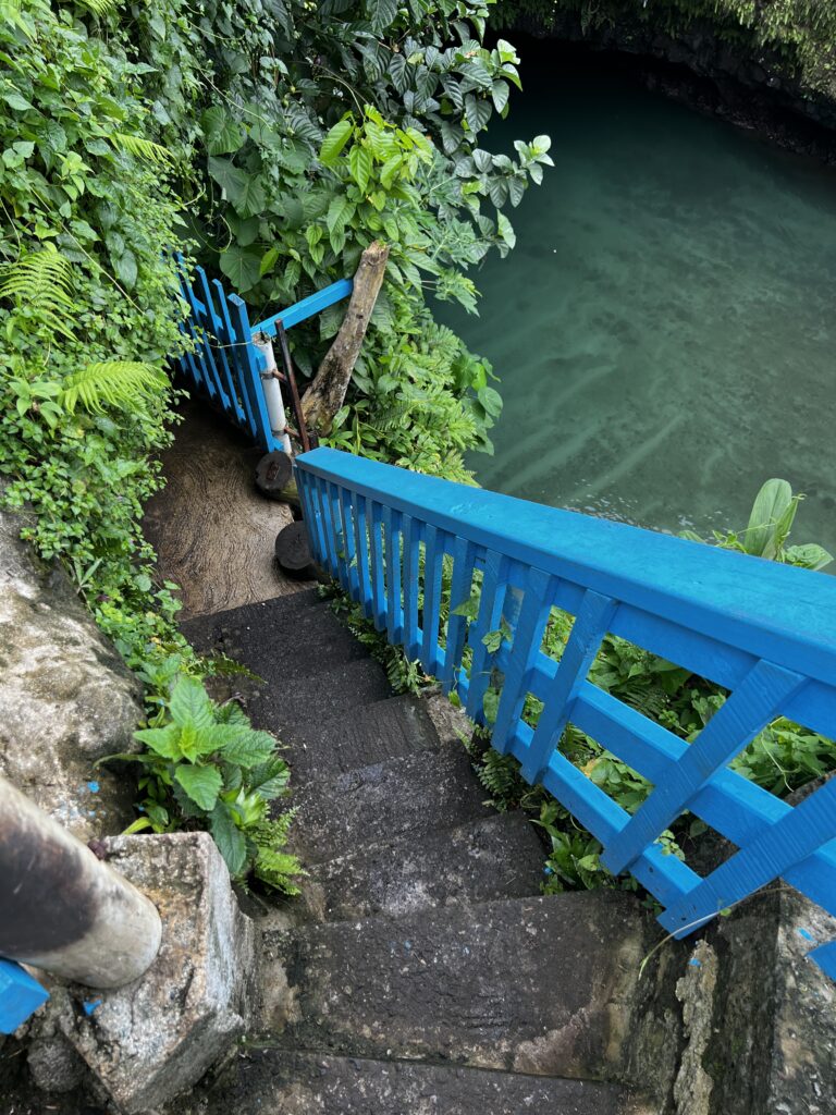
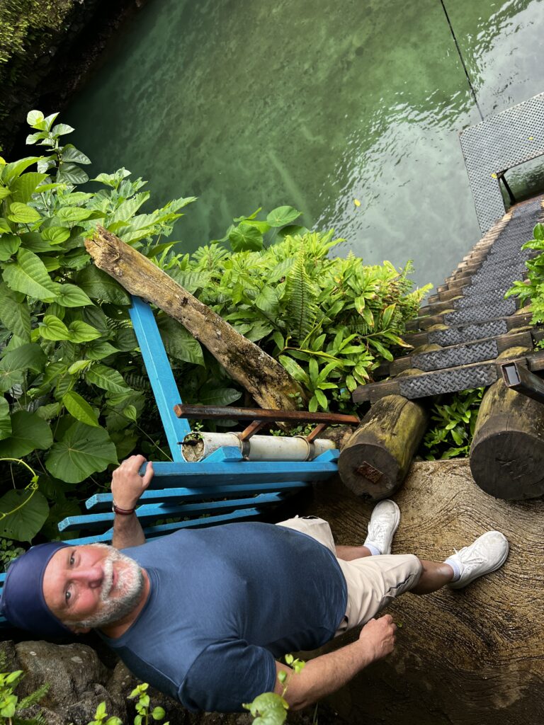
Piula Cave Pool: Piula Cave Pool (also known as Fatumea Pool) is a natural freshwater pool by the sea beneath the historic Methodist Chapel at Piula on the north coast of Upolu island in Samoa. It is situated at Lufilufi in the political district of Atua, 26 km east from the capital Apia, along the scenic coastal road. Entry is by the main road through the painted stone wall of Piula Theological College with steps leading down to the pool.
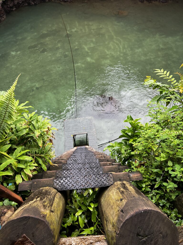
A popular swimming hole for locals and visitors, the pool is formed by a natural spring flowing out of a cave and out to sea. Inside the main cave opening on the north side is a short submerged tunnel leading to a smaller cave opening on the east side of the pool. It is open Mondays to Saturdays and there are small fale and changing rooms for visitors. The monastery charges a small visitor’s fee.
Freshwater pools are fairly common around the coastlines of Savai’i and Upolu islands which were formed from volcanic activity. Cooling lava flows from volcanic eruptions resulted in lava-tunnels that have become conduits for water.
Climb down steps into the freshwater pool. The water is cold. When we were visiting the rain was beginning to fall harder.
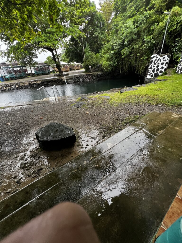
Part of our tour for the day included swimming in this cave, but because of the rain everyone decided to skip the swimming due to the cold-water temperature.
There are fish and freshwater eels in the pool. You swim into the cave and then can exit at another entrance. Sasa said you had to swim about 10 feet under water to pass through the cave.
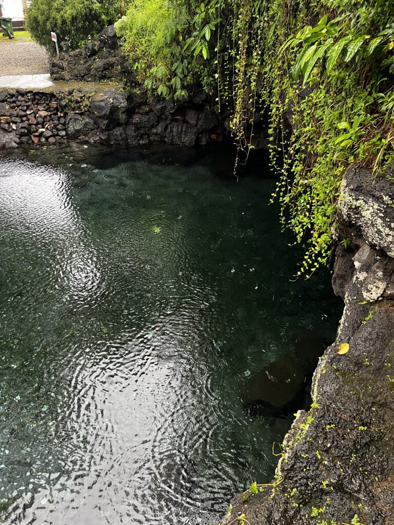
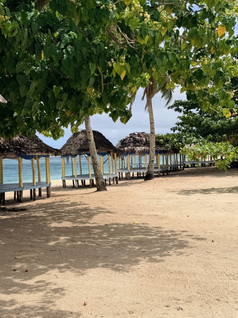
The area is nicely kept with small cabanas and picnic areas that residents can use for parties and relaxing with the kids.
Sopoaga Falls is one of the many waterfalls in southern Samoa on the island of Upolu. The path to the lookout leads through a small botanical garden. Alongside the path to the viewing area are many different types of Samoan plants and trees which are labelled by their Samoan and scientific names.
Splendid gardens fill the surrounding area. There is also an area for umu demonstrations and coconut husking. We began to see the beautiful plants and flowers that are all over this island of Samoa.
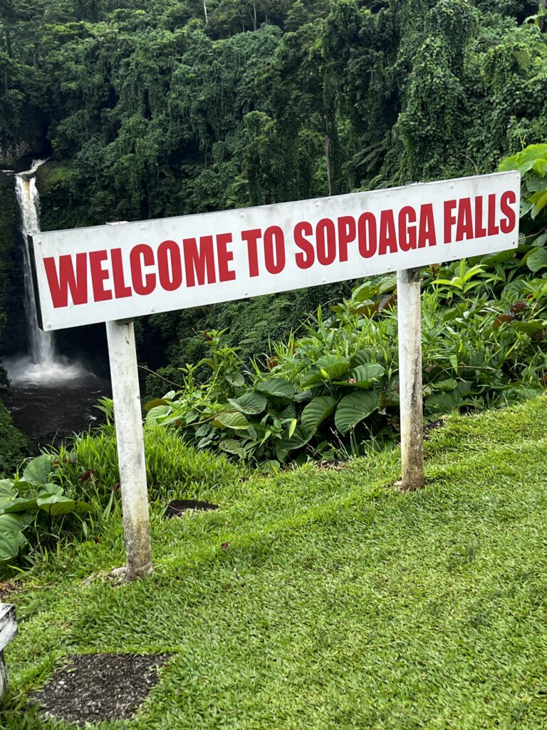
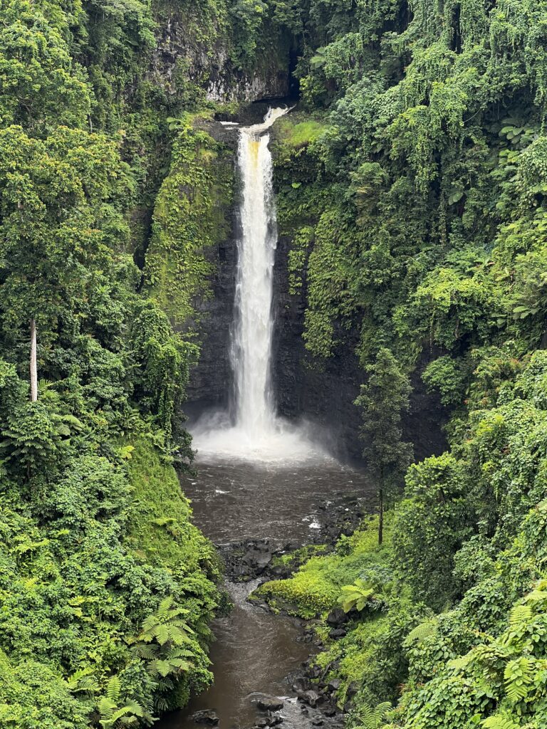
Normally these falls are crystal clear water but when there is heavy rains, the falls are filled with mud and sediment from the wash outs.
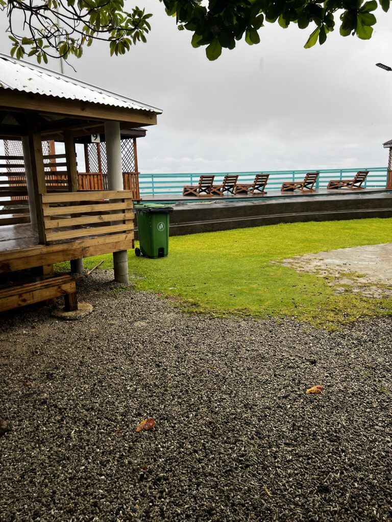
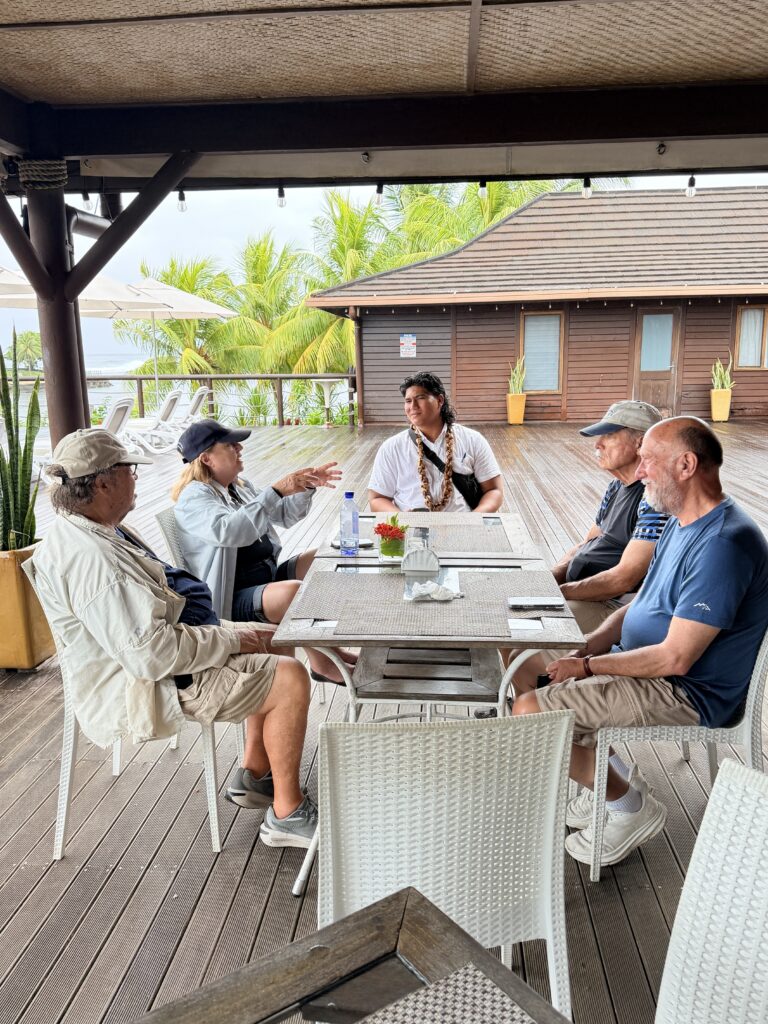
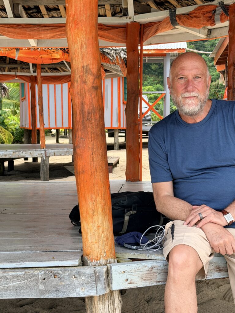
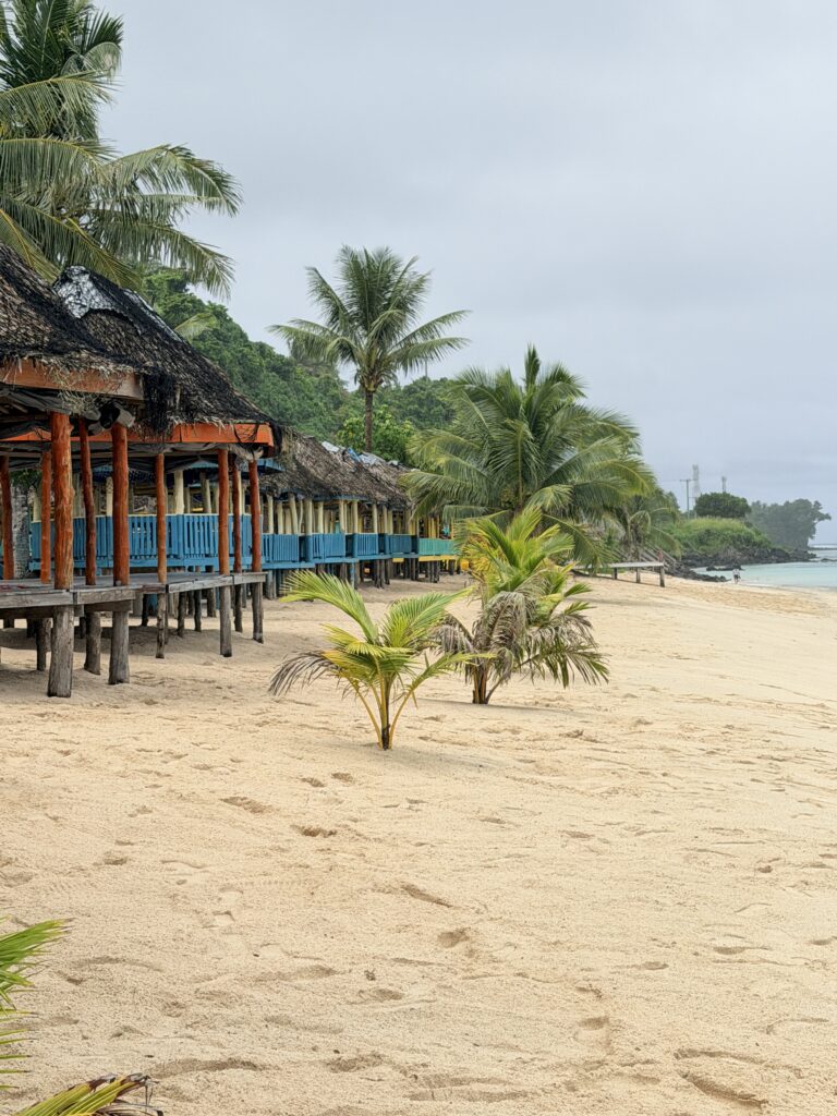
Lalomanu Beach is where we visited after having lunch at a beach resort.
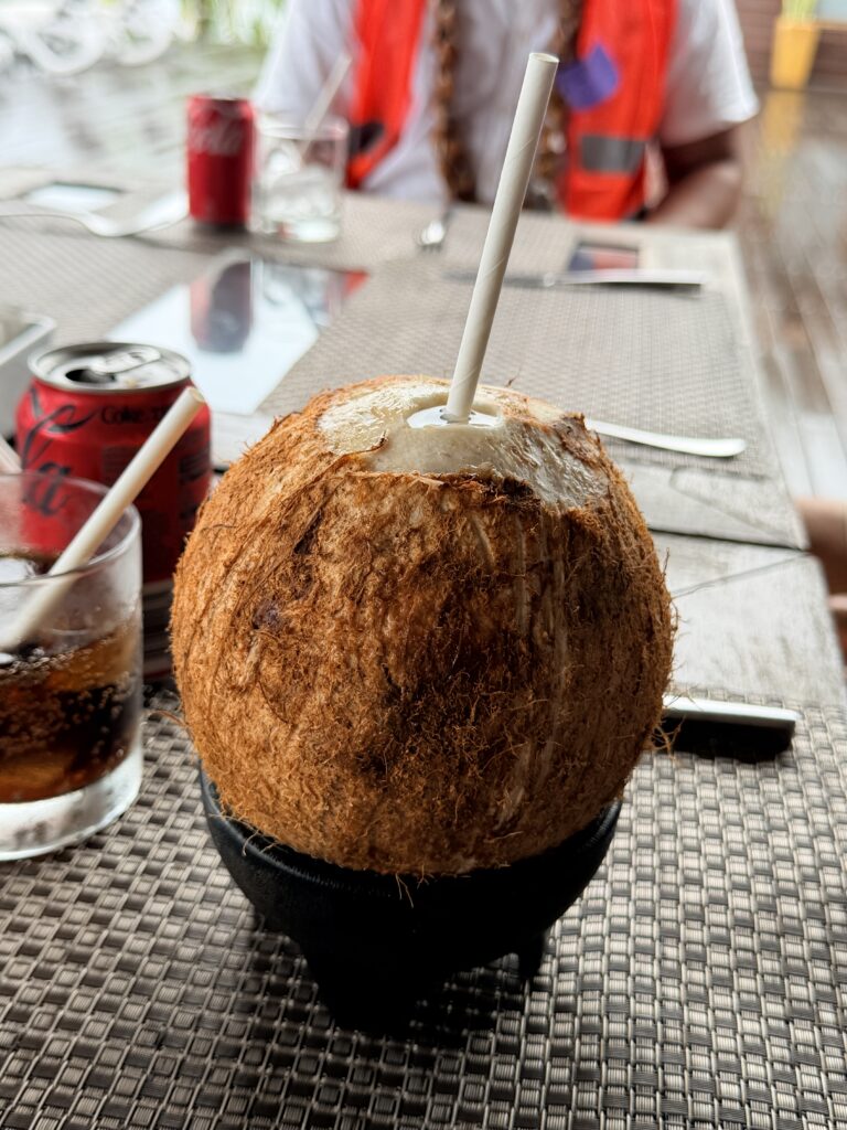
Waiting for lunch to be served. The man next to me is from Key West and the couple is from Miami along with Sasa our guide for the day
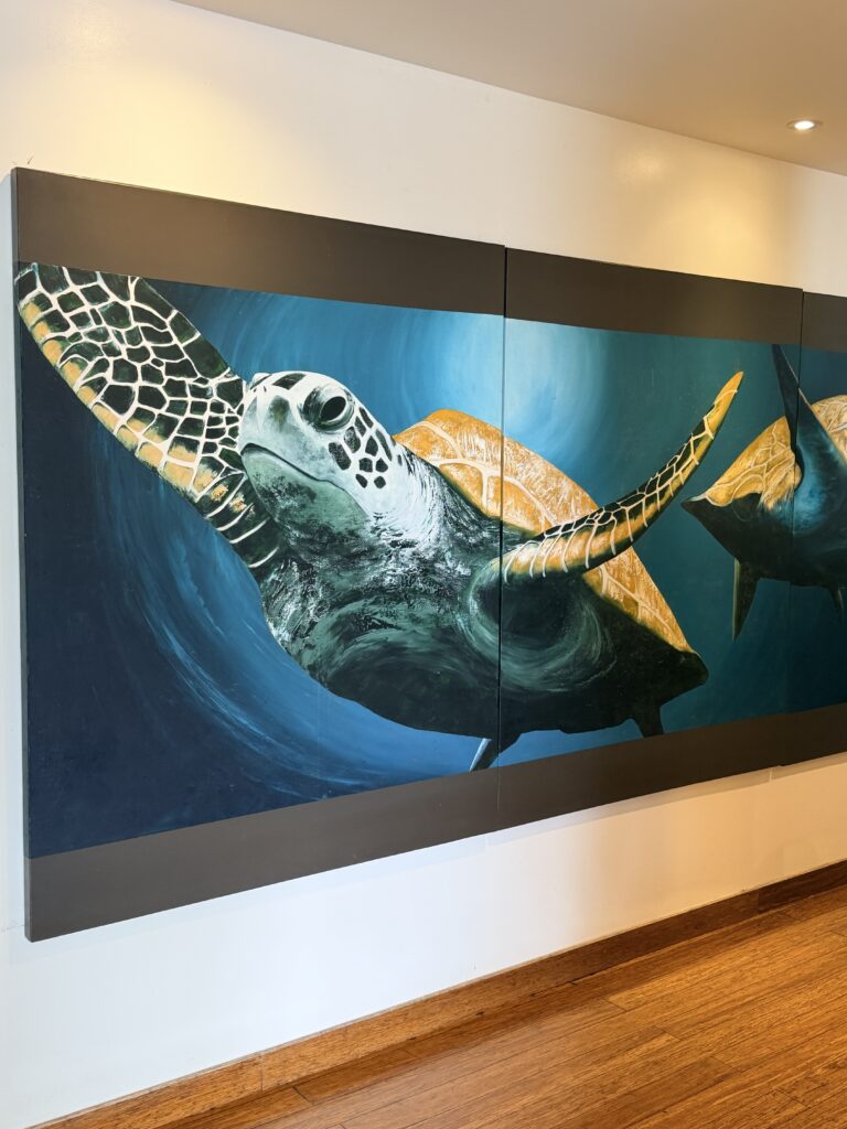
Mural inside the hotel resort
Relaxing at Lalomanu Beach
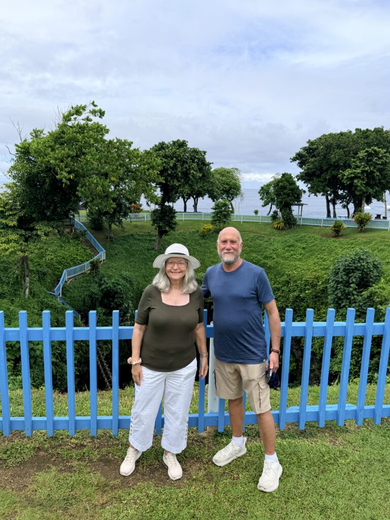
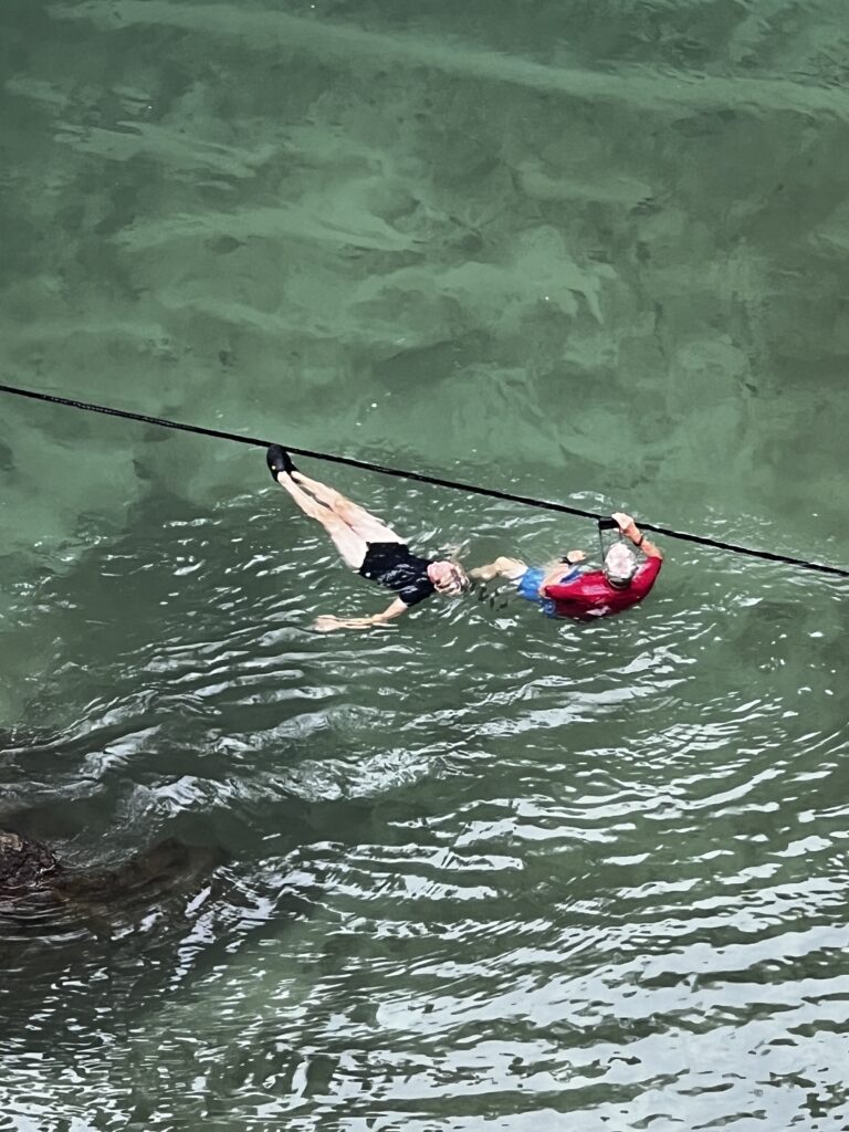
The To Sua Ocean Trench was simply amazing and well scary. 🙂
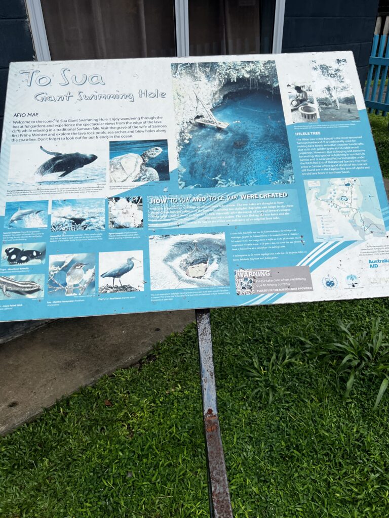
The TO SUA GIANT SWIMMING HOLE is one of the most unique historical site located on the coastal side of Upolu in the village of Lotofaga.
To-Sua literally means ‘giant swimming hole’, 30 metres deep and accessible via a long ladder where a long platform sits for easy access in the pool.
Inside is a cave that leads to the open sea and is recommended for skilled divers. It is surrounded by beautiful native gardens and a spectacular view ideal for weddings, photoshoots and more.
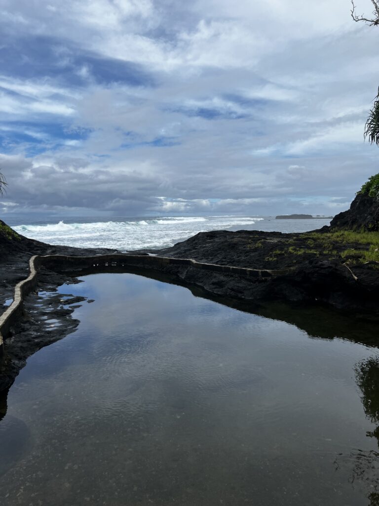
Overlooking the ocean is a small beach known as Fagaoneone meaning white sand, while opposite you can find a lava field with blowholes, mini pools and good fishing spots. If you’re visiting during mid-September to November you may even be lucky enough to see a few whales coasting by.
This is an absolute must-see place to visit while on holiday in Samoa.
As is common in Samoa, many of the natural attractions are run by local families and/or villages and so there is a fee upon entrance.
There are many close-by accommodation options including fales (single/double), toilets and showers and a small shop for chips and drinks.
Swimming Hole | To-sua | Lotofoga
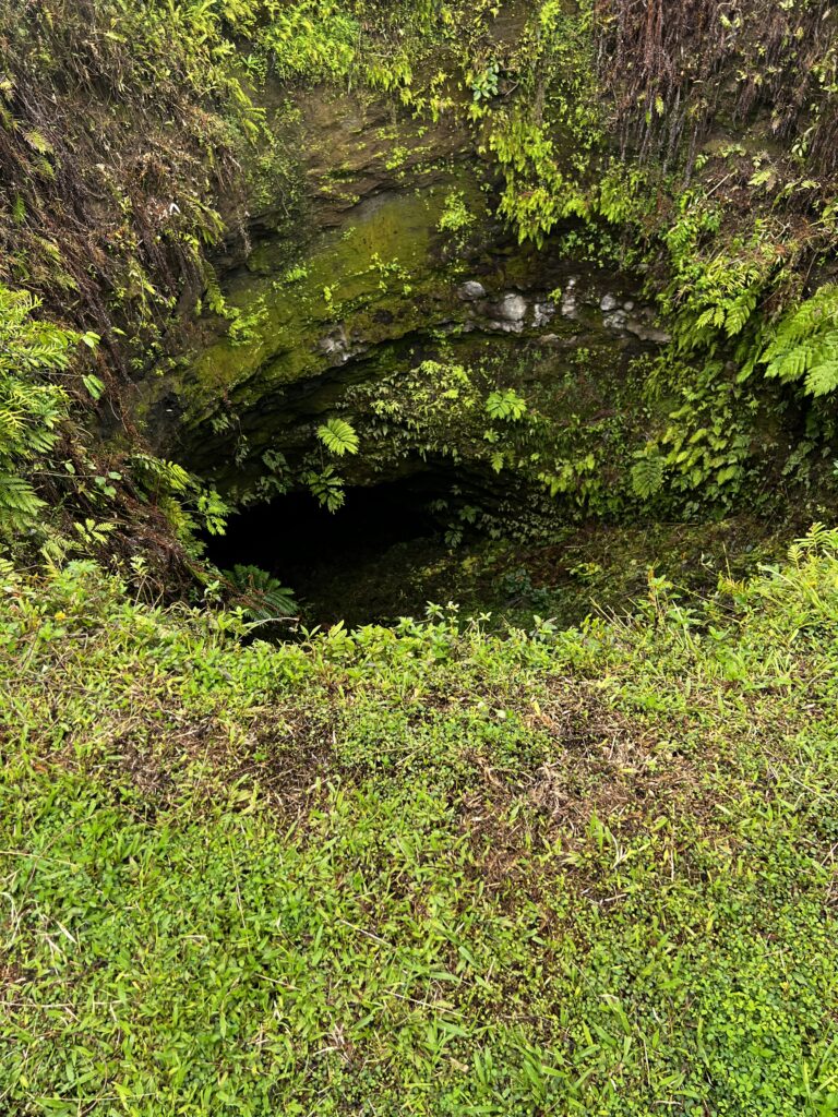
Tour started with a HUGE dry sinkhole
Then, you walk a little way and come across the swimming hole. Ladder does not appear to be too steep
The rope seen in the water is to keep swimmers away from the other side of the rope as the water can suck you out to sea under the rock formation when waves or current is high
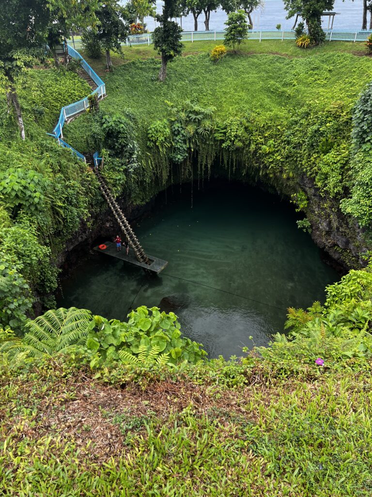
Steps heading down to the ladder
Sasa came down the steps with me and said I will take your photo climbing down the ladder.
Uh, that would be a NO DAWG 🙂 He said just take a couple of steps down and I can make it look like you climbed down. Hmmmm….NOPE 🙂
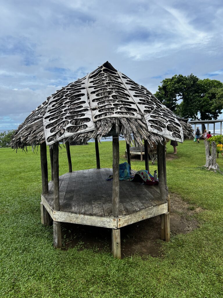
How do you like the roof for these huts? Rubber mats that the bottoms of shoes are cut from are used to hold down the thatched roofs
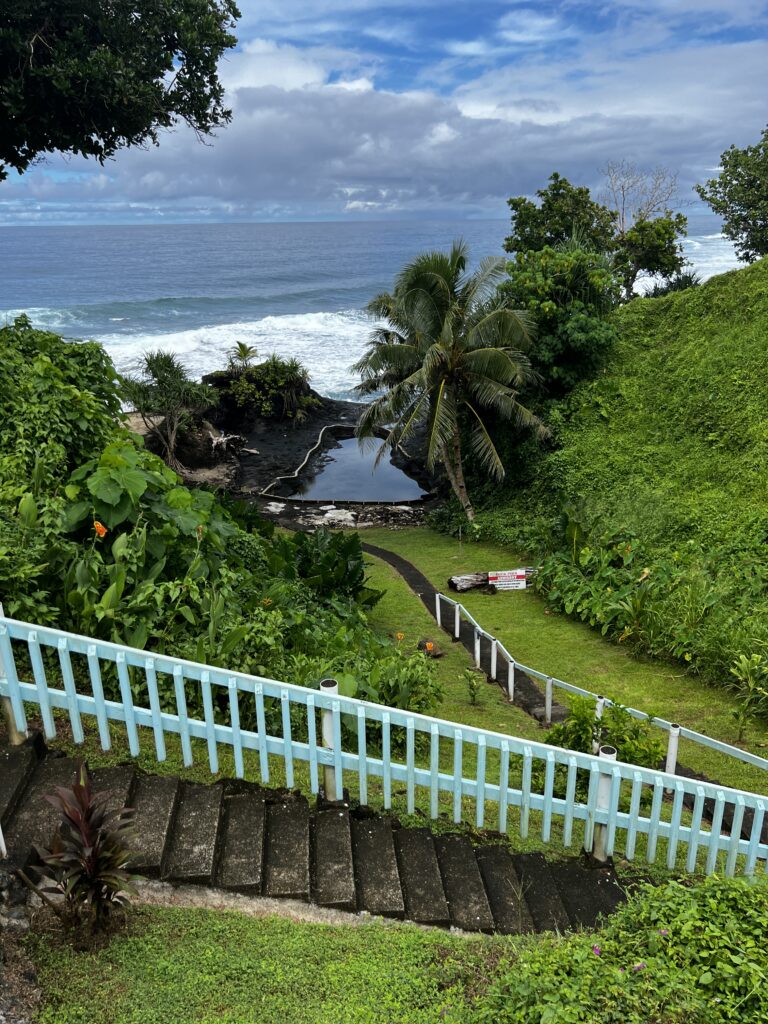
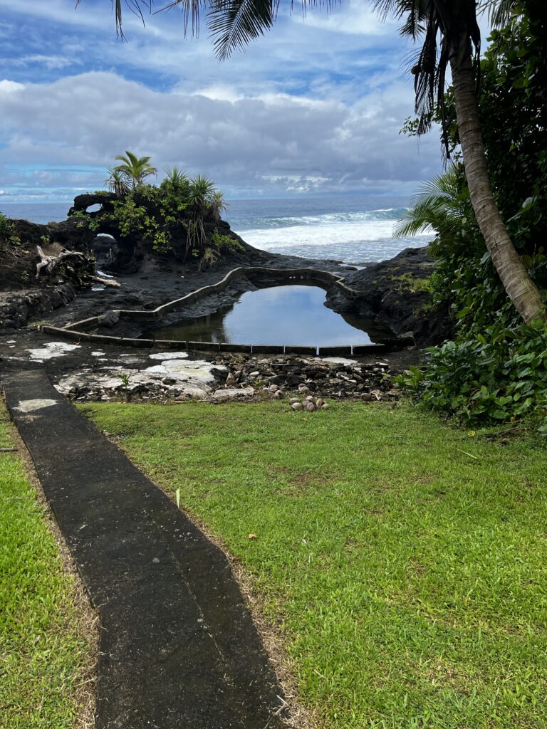
In the same location as the large swimming hole was a rock pool built near the beach for children to swim. It was a climb down the hill to reach it but again just beautiful scenery.
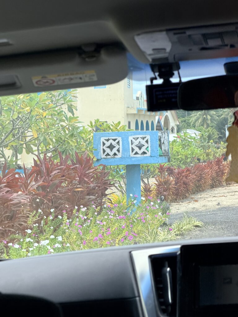
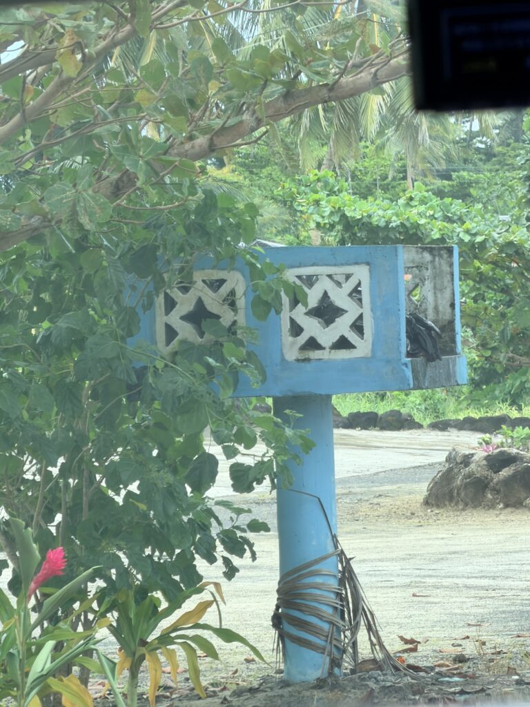
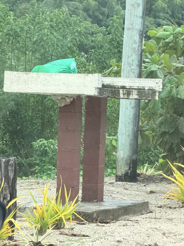
Every home has these stands built in the front yard along the road. They do not utilize garbage cans but place their rubbish on top of the stands for garbage pickup. Some are decorated with fancy designs and others are just a basic stand
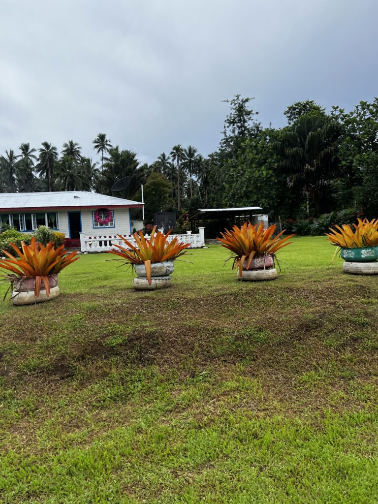
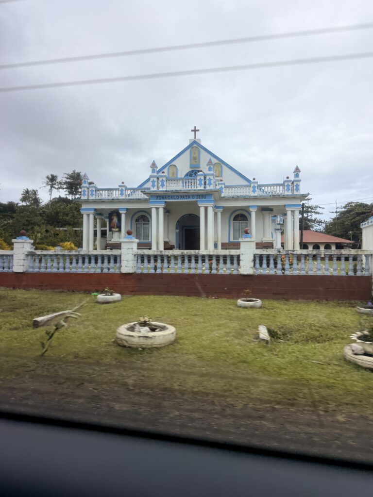
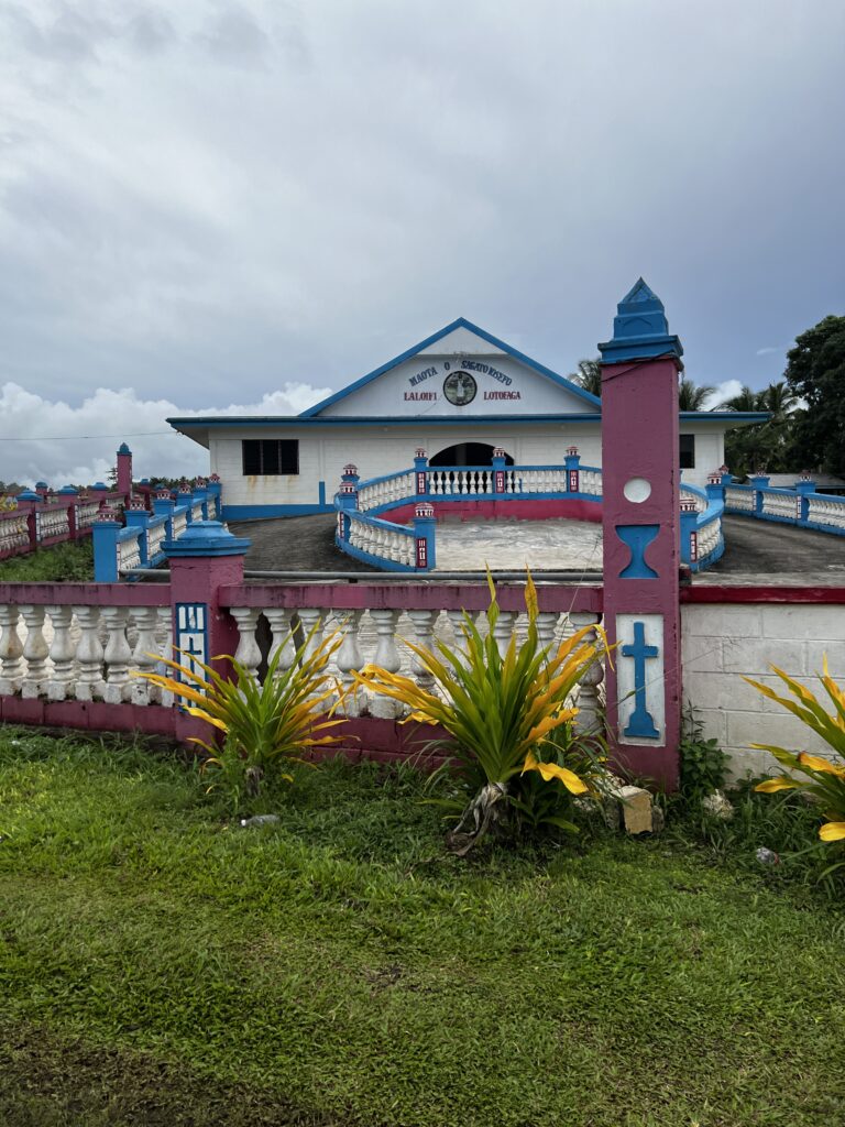
There are a large number of churches scattered throughout the country. Everyone uses old tires as planters which is smart as it is difficult to trash old tires.
Yeah I don’t miss this
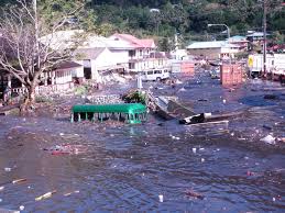
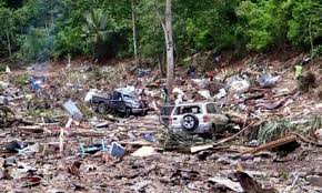
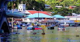
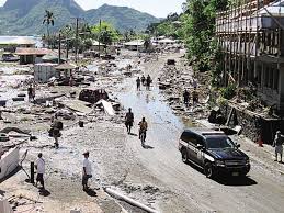
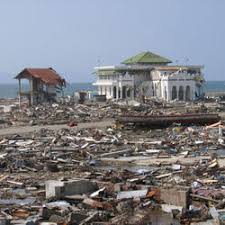
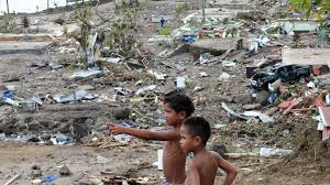
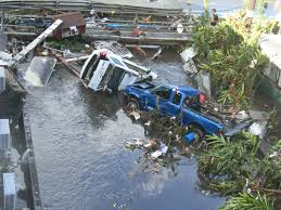
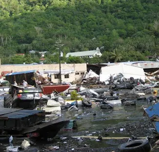
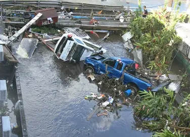
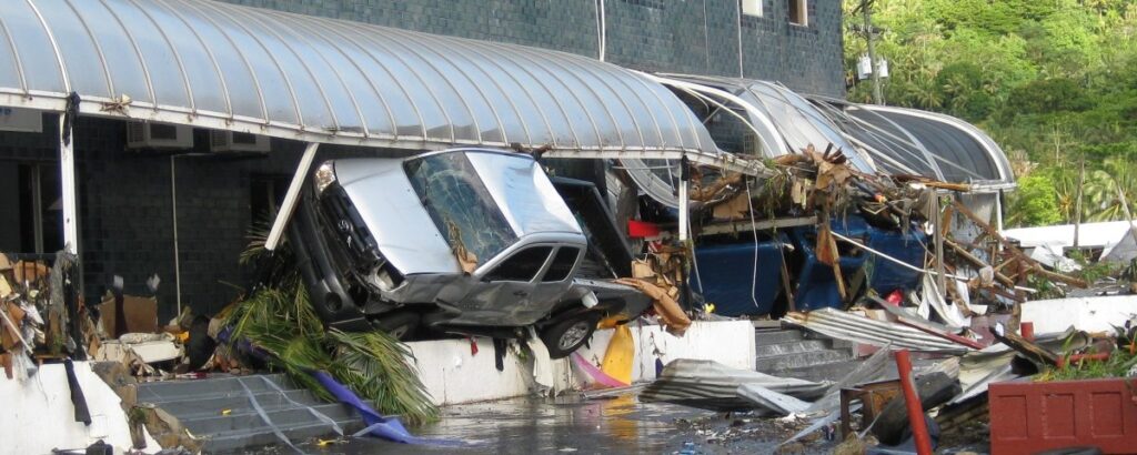
We drove through the area of Samoa where a tsunami hit in 2009 causing widespread damage and deaths. Since all five of us on the tour live in hurricane prone areas we realized the great amount of suffering these people have gone through as they still attempt to build back communities 16 years later. Here is information I copied from various news agencies and a few stock photos I found.
The 2009 Samoa earthquake and tsunami took place on 29 September 2009 in the southern Pacific Ocean adjacent to the Tonga–Kermadec subduction zone. The submarine earthquake occurred in an extensional environment and had a moment magnitude of 8.1 and a maximum Mercalli intensity of VI (Strong). It was the largest earthquake of 2009. The earthquake initiated with a normal-faulting event with a magnitude of 8.1. Within two minutes of the earthquake rupture, two large magnitude 7.8 earthquakes occurred on the subduction zone interface. The two magnitude 7.8 earthquakes had a combined magnitude equivalent to 8.0. The event can be considered a doublet earthquake.
Normal and thrust faulting triggered a tsunami which caused substantial damage and loss of life in Samoa, American Samoa, and Tonga. The Pacific Tsunami Warning Center recorded a 3-inch (76 mm) rise in sea levels near the epicenter, and New Zealand scientists determined that the waves measured 14 metres (46 ft) at their highest on the Samoan coast. The quake occurred on the outer rise of the Kermadec-Tonga subduction zone. This is part of the Pacific Ring of Fire, where tectonic plates in the Earth’s lithosphere meet and earthquakes and volcanic activity are common.
Countries affected by the tsunami, in the areas that were hit are American Samoa, Samoa and Tonga (Niuatoputapu) where more than 189 people were killed, especially children, most of them in Samoa.
Residents in the city of Apia on Upolu island were evacuated to higher ground.[18] Journalist Cherelle Jackson reported that the city quickly emptied in the aftermath of the earthquake and tsunami, “All the schools, workplaces everyone has walked up – it’s like a ghost town.”[18]
Twenty villages on Upolu south side were reportedly destroyed, including Lepā, the home of Samoa’s Prime Minister Tuila’epa Sa’ilele Malielegaoi. In Lepā, only the church and the village’s welcome sign remained standing following the tsunami. The hardest hit areas in Samoa appear to be Fagaloa Bay on the east coast of Upolu, Lalomanu on the south east coast, and along the rest of the southern coast of the island, with one hospital in Apia reporting it had received 79 bodies. The village of Poutasi on the south west coast of Upolu was reported with extensive damage in a TVNZ news item, along with its neighbouring Villages of Satalo and Salani being completely wiped out. A mother at the Taufua Beach Fales in Lalomanu watched her three young children swept away by the tsunami. Elsewhere there were reports of landslides near Solosolo and damage to plantations near Apia.
A number of tourist resorts are located on Upolu’s south coast. These include Coconuts Beach Resort[ and Sinalei Reef Resort and Spa in the village of Siumu. Both resorts published tsunami updates on their websites. The Sa’Moana Resort is in the village of Salamumu.
The eastern part of the island remains without power or water supplies after the earthquake.
A Red Cross worker reported to Radio New Zealand that waves 10 feet (3 m) high had flattened beachside resorts on Upolu, and that residents told him the tourist zone of Lalomanu had been crushed by a wall of water about 20–30 ft (6.1–9.1 m) high. The cliffs above Lalomanu were scoured out to a height of 10–15 m (33–49 ft).
Power outages were reported, and phone lines were jammed. Samoan officials confirmed the runway at Faleolo International Airport on Upolu was safe by early afternoon (30 September 2009).
Samoan Prime Minister Tuila’epa Sa’ilele Malielegaoi, and his Deputy Prime Minister Misa Telefoni Retzlaff were in Auckland, New Zealand, at the time of the earthquake. Both political leaders immediately returned to Samoa. Prime Minister Malielegaoi lost two relatives in the tsunami, including the daughter of one of his nieces.
The Prime Minister made his first address to the nation, after the tsunami, on 1 October. The Government of Samoa estimates the damage at US$147.25 million.
On 2 October 2009, an estimated 3,000 people were homeless and seeking refuge in shelters set up around the worst-affected villages. New Zealand’s Minister of Foreign Affairs Murray McCully visited Apia to co-ordinate New Zealand’s emergency relief effort. New Zealand Prime Minister John Key arrived in Samoa on 3 October and visited some of the most damaged areas on Upolu including the villages of Poutasi and Lalolamu.
The Samoa government and the people of Samoa held a national funeral at Apia Park for tsunami victims on 8 October 2009 (Samoa local time).